
Mission
To foster a sense of pride for the San Jacinto Watershed.
To promote responsible, planned "smart growth" which improves citizens' quality of life, rather than detracting from it.
To encourage responsible ecotourism in the region.
To increase public awareness of the value of forested communities:
forests improve air quality, reduce stormwater runoff, filter water pollutants, increase real estate values, provide wildlife habitat, and are beautiful to gaze upon.
and Legacy Land Trust
nominate Texas' Historic San Jacinto River
American Rivers
Most Endangered River
2006
The River – Why is the river important to the community, region, and nation as a whole?
(300-word limit)
- Size
- Ecological health
- Uses (e.g. drinking water, recreation, irrigation)
- Remarkable features that make it locally, regionally or nationally significant
- Natural, cultural, historic and economic values
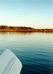
The San Jacinto River is an underappreciated ecological and recreational gem with a history few know. The river has an East and West fork (69 and 90 miles) which wind their way through bottomland hardwood forest, meet at Lake Houston and continue for an additional 28 miles to Galveston Bay. Akokisa Indians camped along her banks, as did later explorers and settlers, including the infamous men who fought the Texas Revolution. General Sam Houston dramatically ended the Texas Revolutionary War on the banks of the San Jacinto when he defeated Mexican General Santa Ana on April 21, 1836. The Allen brothers founded Houston upstream on Buffalo Bayou, a tributary, the same year. Exxon got its start when two locals discovered oil bubbling from the San Jacinto near the town of Humble, leading to an overnight tent city.
The river serves as the historic western edge of the Big Thicket[i], a heavily forested region unique enough to be dubbed a U.N. Biosphere Reserve due to its extremely high biodiversity. In addition to segments of primeval cypress swamp, the riparian forests lining its banks have a stunning diversity of tree species – including the American hornbeam, hophornbeam, two-winged silverbell, river birch, tupelo, magnolia, sugarberry, cottonwood, dogwood, sumac, black cherry, Mexican plum, mulberry, hollies, elms, ashes, hickories, oaks, and pines[ii].
A recent study[iii] found that the upper San Jacinto tributaries remain the healthiest stream reaches in the entire watershed which includes hundreds of streams and bayous – Houston is, after all, the “Bayou City.” Several rare, threatened and endangered species use this area, including nesting bald eagles, wood storks, white ibises, and Swainson's warbler. The riparian forests provide a stopover for neotropical migratory birds just crossing from the Gulf of Mexico. The river has two reservoirs, Lake Conroe and Lake Houston, which provide drinking water to Houston area residents. The river is the home of “East Fork West Fork Challenge” a unique le mans style start-at-night 16-mile canoe race.
The Threat(s) – Why is the river’s future uncertain?
(500-word limit)
- Provide detailed information on the major threat(s) facing the river (e.g., proposed development, water withdrawals, pollution, land use conflicts, dams, water projects)
- Explain how the threat(s) impacts river heath (e.g., fish kills, flow alterations, loss of riparian habitat)
- Address the seriousness and imminence of the threat(s). Focus on the threats which you believe to be the most significant and pressing.
The river is threatened by sand mining, development in the riparian forest, and water rights grabs. Sand mining involves excavation of bottomland hardwood forested wetlands adjacent to the sandy river banks. The companies buy land, clearcut, gouge out sand by the tons often with sediment leaching into the river, and leave town, with no reclamation required. They can’t legally dump sediment in the river without a Corps of Engineers “fill” permit but violations are rampant. Harris County’s Dennis Johnston went on a helicopter flyover and was shocked by the scale of devastation. He said it looked like bombs had been dropped, and in many places, leached sediment turned the river the color of cream-colored coffee, clear legal violations.
According to Texas Parks & Wildlife Department (TPWD), increased sedimentation in the San Jac has had several effects: as the river has filled in, it causes braiding, which leads the river to widen to contain its flood flows, which in turn causes bank erosion[iv]. Downstream of the sand pits, Lake Houston, a reservoir which provides drinking water to the City of Houston and elsewhere, has silted in at an excessively high rate - up to 20% since it was constructed in 1954[v]. This has reduced the amount of water the reservoir can hold and particularly as the San Jacinto River Authority continues to sell more water to other entities, less water runs downstream to provide Galveston Bay estuaries their critical freshwater inflow. At our request for this nomination, TPWD estimated the extent of sand mining at over 3,000 acres adjacent to the river just between Lake Conroe and Lake Houston using GIS (photo included).
The river faces impending and current land development along its boundaries. Developers clearcut right up to the water and don’t leave a forest buffer as has been recommended by Houston’s Bayou Preservation Association. One day I (WH) was on my daily run across the bridge over the East Fork, and spotted a bald eagle perched on a tall dead snag. Although I’d run this route for eight years and knew eagles nested here, I’d never seen one here. Two days later, developers clearcut several acres of forest right up to the water’s edge to prepare for a mixed-use development. The San Jacinto riparian forests provide the last remnant in Houston of the historic Big Thicket, and protect the waterways by filtering water pollutants from runoff and reducing flood potential and associated damage to human structures and threat to life in Houston’s already flood-prone and heavily developed urban expanse.
Last, seven pending water rights permits which amount to massive quantities of water removal from the river are under review by the Texas Commission on Environmental Quality (TCEQ). In an 11-page permit review letter, TPWD urges, “The cumulative impact from this and other pending applications could prove detrimental to aquatic and riparian habitats in the San Jacinto River…and to Galveston Bay.”
Actions or Decisions – How will the river’s fate be determined in the coming year?
(500-word limit)
- Provide detailed information on major actions or decisions anticipated in the coming year (remember that the report will be issued in April 2006) that could magnify or lessen the threat(s) (e.g. legislation, change in government regulation, issuance of permits)
- Identify the best protective action(s) that can be taken to eliminate the threat(s)
Sand mining and development:
Legacy Land Trust is working to preserve 10,000 acres of roadless wilderness in between the river’s West Fork and Spring Creek. A sand mining company just bought property adjacent to LLT’s most prized easement property, Curry Lake. Developers are eyeing the land and our last chance to preserve this “lost wilderness” of Houston (aka the Little Thicket) will disappear if action to set aside this land does not occur soon. Midway Development is developing “Spring Trails”, a massive master-planned community and another developer just put a contract on land in this Little Thicket region, while Friendswood Development has planned subdivision developments further downriver.
In 2004, TCEQ launched a Clear Streams Initiative to investigate sand mining. Initially, the state agency formally brought attention to the Initiative with a press conference, announcing levied fines of $3 million to the 45% of operators statewide operating illegally. But then TCEQ did an about-face and reduced the entire state total fines to $30,000 and reported, “The overall finding of this review is that the waterways on the State of Texas are not significantly impacted by mining activities.”
Local governments can prevent sand mining from occurring in their area, but the ultimate protection will come through state legislation protecting the river, and requiring reclamation and reforestation. Harris County just launched an investigation to keep sand mining off of Spring Creek, a major tributary, and 2006 will see its results. Sand mining has received little attention nationwide. Legislators respond to egregious wrongs such as sand mining when a public light is shined upon them. Sand mining could be turned into a far more sustainable operation; pits could be reclaimed as lakes or used as offroad vehicle (ORV) racing tracks rather than scarring up pristine forests and river banks.
Water rights:
In a bold move, Galveston Bay groups recently filed a water rights claim for 4 million acre-feet of water from the San Jacinto River to ensure adequate freshwater for a healthy Galveston Bay. TCEQ dismissed the application as invalid, but attorney Jim Blackburn is scheduled to fight in federal appeals court this year to ensure that water applications for “environmental” rather than consumptive use – which keep water in the river rather than take it out – are not summarily dismissed. In addition, several of the pending consumptive water rights permits will likely be decided within the year.
Two protective actions could help the river: (1) Congressman Brady is drafting legislation for the Big Thicket National Preserve at this time. We are encouraging BTNP to acquire the Little Thicket as the only Wilderness for their preserve. Congress would have to authorize this action, and national attention of its value would certainly help since development interests typically outcompete conservation interests for land unless awareness is raised. (2) In the next year, SJCC would like to lead efforts to develop a comprehensive watershed plan for the San Jac, requesting input from strategic partners such as TPWD, Harris County Flood Control District, the City of Houston and others. We would document and summarize current threats, then develop a plan to create a healthy, sustainable river.
The San Jacinto River’s selection as an endangered river would raise awareness of the national importance of this river both ecologically and historically, and could spur legislators to take real action to better regulate sand mining, require some form of reclamation, and scientifically evaluate the freshwater inflow issue. There is no question that next year will see much of the river’s riparian forest being lost unless something is done to change the tide.
III. ADDITIONAL MATERIALS & MEDIA
Only if especially useful to the nomination, include additional relevant materials like maps, video, press clippings, or photos.
Included:
- Aerial image documenting extent of sand mining along the river with statistics on its extent based on a TPWD GIS analysis (William Schubert, pers. comm).
- SWCA Mitigation document with photos of riparian forest and aerial of land prior to more extensive sand mining and development.
- Moonlight Meander on the San Jacinto by Wendee Holtcamp. Texas Parks & Wildlife Magazine. June 2000.
- Why Rivers Need Forest by Wendee Holtcamp. Texas Parks & Wildlife Magazine. Dec. 2001.
- Canoe Challenge! By Wendee Holtcamp. Texas Parks & Wildlife Magazine. Feb 2002.
To view the 2005 report, please visit us online at www.americanrivers.org/endangeredrivers.
[i] McLeod, C.A. 1967. The Big Thicket of East Texas: Its History, Location and Description. The Sam Houston Press, Huntsville, Texas.
[ii] Holtcamp, Wendee N. June 2000. A Moonlight Meander: Kayaking the San Jacinto River after the Sun Goes Down Has its Own Special Charm. Texas Parks & Wildlife Magazine. Texas Parks & Wildlife Department.
[iii] Moring, J. Bruce. 2001. U.S. Geological Survey. Influence of Stream Habitat and Land Use on Benthic Macroinvertebrate Indicators of Stream Quality of Selected Above-Tidal Streams in the Houston-Galveston Area Council Service Area, Texas, 1997-1998. Water-Resources Investigations Report 01-4010.
[iv] Sipocz, Andy, TPWD. Personal Communication.
[v] Norris, Chad TPWD permit review letter to San Jacinto River Authority, Jan. 31, 2005.